
Bernese Oberland · Hiking
Best Hikes in Kandersteg
Last updated November 2026
Kandersteg's classic hikes are the Oeschinensee panorama trail, the Gemmi Pass crossing from Sunnbüel, and the Gasterntal valley walk. Strong hikers climb from Oeschinensee to the Blüemlisalp hut. Families should take the direct lake path or the Arvenseeli loop at Sunnbüel.
Some booking links may earn us a commission at no extra cost to you. How this guide is funded →
Hiking is why many people come to Kandersteg: shore paths at Oeschinensee, the Gemmi Pass crossing, Gasterntal river walks, hut approaches and family loops.
Use this overview to pick a day that matches your fitness and season, then open the detailed route page. Start with Oeschinensee hike, Gemmi Pass, Gasterntal, Blüemlisalp hut or the via ferrata. Early starts are easier if you stay overnight; check weather before exposed days.
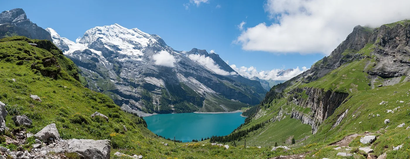
Oeschinensee panorama toward the Doldenhorn — trail country above Kandersteg.
Quick facts
- Classic lake
- Oeschinensee C / panorama G
- Classic pass
- Sunnbüel → Gemmi → Leukerbad
- Quiet valley
- Gasterntal walks
- Hut day
- Hohtürli / Blüemlisalp hut
- Family
- Trail C or Arvenseeli loop
- Rail base
- Between Brig ~38 min and Bern ~61 min
Which hike?
Times are typical patterns from operators — always re-check the linked page and live status before you go.
| Hike | Start | Time (pattern) | Level | Season | Page |
|---|---|---|---|---|---|
| Oeschinensee direct (C) | Mountain station | ~20–30 min | Easy | When open | Oeschinensee hike |
| Oeschinensee panorama (D/G) | Mountain station / Läger | D ~40′; G ~1 h 30 | Easy path / mountain | Summer–autumn (check ice) | Oeschinensee hike |
| Gemmi Pass | Sunnbüel | ~8–9 km, 3–3.5 h | Moderate | Lift + trail season | Gemmi Pass |
| Gasterntal valley | Kandersteg / Chluse | Half–full day | Easy–moderate | Late spring–early autumn | Gasterntal |
| Blausee riverside | Kandersteg | ~5.2 km / ~1 h 25 (TALK) | Easy | Year-round access pattern | Blausee |
| Blüemlisalp hut via Hohtürli | Oeschinensee / Oberbärgli | Long mountain day | Hard | Hut season from June | Blüemlisalp hut |
| Doldenhorn hut (J) | Kandersteg / Waldhotel | ~2 h 20 | Hard | From mid-May pattern | Blüemlisalp hut |
| Allmenalp via ferrata | Allmenalp valley station | ~2–3 h climb | Hard / exposed | Late spring–autumn | Via ferrata |
| Via Alpina to Adelboden | Kandersteg | ~16–17 km / ~6 h 45 | Hard | June–September pattern | Official Via Alpina pages |
Kandersteg station is described as lying between Brig (38 min) and Bern (61 min) with hourly service — a practical hiking base on the Bern–Brig spine.
Easy
Oeschinensee direct path (C) — the default lake walk after the gondola: wide path, about 20–30 minutes to the shore when open and marked suitable for baby carriages. Full letter table on Oeschinensee hike.
Arvenseeli loop (Sunnbüel) — Sunnbüel’s trails overview describes a family-friendly loop toward the Arvenseeli and stone-pine forest (roughly 1.5 h class). Details and live status on Gemmi Pass / sunnbuel.ch.
Blausee riverside walk — TALK describes an easy Kandersteg–Blausee walk of about 5.2 km and roughly 1 hour 25 minutes downstream along the Kander. Park admission still applies at the gate — see Blausee.
Moderate
Oeschinensee panorama (D/G) — trail D via Läger (~40 minutes) plus mountain trail G Läger–Heuberg–Oberbärgli (~1 h 30) for the elevated lake views. Mountain boots and weather judgement required; early winter ice on G is called out by the operator.
Gemmi Pass — Sunnbüel cable car, then historic trail past Schwarenbach and Daubensee to the pass, with Gemmibahn options to Leukerbad. About 8–9 km and 3–3.5 hours walking — Gemmi Pass.
Gasterntal — unspoilt side-valley walks without lifts; bus booking or one-way gallery access rules apply — Gasterntal.
Hard / alpine
Hohtürli and the Blüemlisalp hut — long mountain day from the Oeschinensee bowl via Oberbärgli and trail H. Blüemlisalp hut.
Doldenhorn hut (trail J) — Trail J Kandersteg–Doldenhorn hut via Waldhotel is listed at about 2 h 20 and described as challenging, only with proper mountain hiking gear.
Allmenalp via ferrata — K4 exposed climb, not a hiking path. Read via ferrata and hire a certified guide if you are unsure. We describe; we do not instruct rope technique.
Maps
Do not rely on a single blog GPX. Use:
- Oeschinensee digital map / trail status (and the wandern page)
- Sunnbüel routes overview
- Swisstopo / map.geo.admin.ch for national mapping
Paper 1:25,000 sheets still help when batteries die. Lettered Oeschinensee paths change with rockfall and works — the interactive map beats a screenshot from last summer.
Safety and status
We describe routes and link operators. We do not declare any trail “safe,” and we do not give mountaineering instruction.
A large section of the southeastern shore is a cantonal restricted area because of rockfall risk — access is prohibited; respect barriers and ranger advice. After rain and freeze–thaw cycles the operator warns that rockfall risk rises on exposed ground. Pair that with the weather checklist the same morning.
Stay longer for multi-day hiking
One night unlocks an early gondola or Sunnbüel start; two nights unlock Gemmi plus lake, or a hut approach with a weather buffer. Compare village and spa bases on where to stay.
A second look at where to stay before you stack hard days is cheaper than a taxi after missing the last bus from Leukerbad.
Prefer a guide for panorama letters?
Private guided panorama hiking from the Tourist Center is one way to stop guessing D/G combinations:

Photo: GetYourGuide
Village favourite
Kandersteg: Oeschinensee Panorama Hike with a Swiss Athlete
- Private guided panorama hike
- Gondola optional at extra cost
Listing checked November 2026
Guides do not override closures. For ferrata guiding contacts, use the operator links on via ferrata.
How to use this hub
Start with fitness and weather, not Instagram. Families → C or Arvenseeli. First alpine day → Gemmi or Gasterntal. Hut ambitions → Blüemlisalp hut only after you have already been honest about mountain-trail experience. Keep Oeschinensee hike open for letter detail and weather open for the morning go/no-go.
A practical weekend pattern for many visitors: night one in the village from where to stay, early Oeschinensee on trail C or D/G, night two still in Kandersteg, then either Gemmi toward Leukerbad or a quieter Gasterntal day if the high forecast fails. That sequence beats trying to “do the lake, the pass and a hut” in one daylight window from an Interlaken hotel.
Search interest in a Kandersteg hiking map is really a request for official sources: lettered Oeschinensee paths, Sunnbüel tiles and Swisstopo. A single static PNG in a blog post goes stale the first time rockfall closes a sector. Bookmark the operator status pages and treat this hub as the menu, not the live closure feed.
Dogs belong on the trip only if you accept leash rules, gondola tickets and wildlife quiet zones — and if your dog’s fitness matches mountain days, not just village pavements. Blausee’s park rules differ from free alpine shore; read Blausee before you assume every blue lake is the same product.
Finally, remember the rail geography that makes multi-day hiking realistic here: Kandersteg sits on the Bern–Brig line with frequent trains, so a Gemmi descent into Valais or a Via Alpina finish in Adelboden can still return you to a suitcase in the village when connections cooperate. Check those returns in SBB the same way you confirm trail letters — ambition without a last-bus plan is how classic days become expensive taxis.
Your questions, answered
What is the best hike in Kandersteg?
For most first-timers, the Oeschinensee direct path plus shore time — or the panorama / Heuberg mountain segments if you are sure-footed. Strong walkers often pick the Gemmi Pass from Sunnbüel. “Best” depends on fitness, weather and whether you want a lake, a pass or a hut.
Are there easy hikes?
Yes. Trail C from the Oeschinensee mountain station to the lake is the wide family path when open. Sunnbüel’s Arvenseeli loop and the riverside walk toward Blausee are other gentler options. Mountain letters G–J and the via ferrata are not easy.
Do I need a map?
Yes for anything beyond the short lake path. Use the official Oeschinensee interactive map, Sunnbüel route pages and Swisstopo / map.geo.admin.ch — not a single stale blog screenshot.
When is hiking season?
Lower valley and lake walks stretch into shoulder months when open; high mountain trails and SAC huts concentrate from late spring or June into autumn. Via ferrata and Gemmi lifts have their own windows. Always check live status the morning you go.
Can I hike from Kandersteg to Adelboden?
Yes on Via Alpina stage 14 (Kandersteg–Adelboden via Bunderchrinde), a long difficult mountain stage of about 16–17 km and roughly 6 h 45 min on official destination and SwitzerlandMobility pages. It is not a casual lake stroll.
Are dogs allowed?
Dogs are common on destination trails but must be kept on a leash in the Oeschinensee / Sunnbüel area, especially in wildlife quiet zones and during grazing season. Gondola dog tickets are separate — check the operator FAQ. Blausee allows dogs on a leash in the park.